

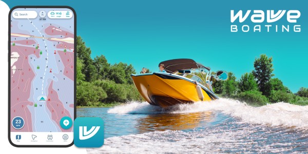
Marine charting apps have become essential tools for modern boaters. Whether you are planning a fishing trip, navigating unfamiliar waters, or cruising along the coast, having accurate charts and reliable navigation tools can make a major difference in safety and overall experience.
Among the most commonly compared charting platforms are C-MAP and Navionics. Both are widely used across chartplotters and mobile apps, but they are designed with slightly different priorities in mind. That is why many boaters research cmap vs navionics to understand which system better fits their needs.
What both apps have in common
C-MAP and Navionics are both high-quality marine charting systems that provide:
- GPS-based positioning
- Digital nautical charts
- Route planning tools
- Depth contours and hazard information
- Points of interest such as marinas and docks
Both platforms are used globally and are compatible with many marine electronics and mobile devices. They are capable of supporting everyday boating, fishing, and navigation tasks effectively.
However, their differences become clearer when you look at how they present data and what features they prioritize.
Chart detail and usability
Navionics is widely known for its detailed charts and user-friendly interface. Many boaters find it easier to get started with, especially when planning routes or navigating unfamiliar areas.
It also offers features like sonar charts and community edits, which provide updated depth information based on real user data. This can be particularly useful in frequently travelled waterways where conditions change over time.
C-MAP, on the other hand, is often praised for its clean presentation and high-resolution bathymetry. Its charts are designed to be visually clear, making it easier to interpret underwater terrain without overwhelming the screen.
For some boaters, especially those who prefer a simpler visual layout, this can make navigation more intuitive.
Depth shading and seabed visualization
One of the biggest differences between the two platforms is how they display underwater terrain.
C-MAP is known for strong depth shading and relief features, which provide a more detailed visual representation of the seabed. This makes it particularly useful for fishing, diving, or exploring new areas where understanding bottom structure is important.
Navionics also offers depth shading, but its strength lies in combining chart detail with user-generated sonar data. In areas with heavy user activity, this can result in highly detailed and frequently updated maps.
Compatibility and flexibility
Navionics has a clear advantage when it comes to compatibility. It works with a wide range of chartplotters and sonar systems, making it a flexible option for boaters using different brands of marine electronics.
C-MAP is more commonly associated with specific systems, particularly Lowrance and B&G devices. While it still offers strong functionality, this more limited compatibility can influence which system boaters choose.
For those using mobile devices as primary navigation tools, both apps provide standalone functionality, but Navionics is generally considered more widely supported.
Route planning and features
Both platforms offer route planning tools, but Navionics is often seen as more advanced in this area. Features like dock-to-dock auto routing and community updates make it easier to plan efficient routes.
C-MAP also includes route planning and automatic routing features, along with additional tools such as customizable chart layers and points of interest.
However, some users report that Navionics offers a smoother overall experience when it comes to planning and syncing routes across devices.
Which is better for fishing
For fishing specifically, both apps have strengths.
C-MAP is often preferred for its detailed seabed visualization and ability to highlight underwater structures such as rock piles and drop-offs. These features can help anglers locate productive fishing areas more efficiently.
Navionics, on the other hand, provides strong chart detail and community-driven data, which can be useful for identifying popular fishing spots and updated depth information.
In general, C-MAP tends to excel in visualizing terrain, while Navionics excels in providing updated and community-supported data.
Ease of use and learning curve
Ease of use is another important factor.
Navionics is often considered more beginner-friendly due to its intuitive interface and straightforward design.
C-MAP offers more customization and control over chart layers, but this can come with a slightly steeper learning curve for new users.
The choice here often depends on whether a boater prefers simplicity or advanced customization.
Choosing the right charting app
There is no single winner between C-MAP and Navionics. The best choice depends on how you use your boat and what features matter most to you.
- Choose Navionics if you want ease of use, strong compatibility, and community-driven updates.
- Choose C-MAP if you prefer detailed seabed visualization and customizable chart displays.
Many experienced boaters even use both systems, taking advantage of each platform’s strengths.
Navigating with better tools
Marine charting apps continue to improve as technology advances. Today’s boaters have access to tools that combine charts, GPS, and real-time data in ways that were not possible just a few years ago.
By understanding the differences between charting platforms, you can choose tools that match your boating style and help you navigate more confidently.
With the right setup, marine navigation becomes not just easier, but safer and more enjoyable every time you head out on the water.


